Temperatures crashed to around the freezing mark in New Jersey early Thursday morning, a day after much of the state experienced highs in the 60s.
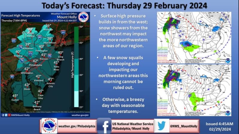
It won’t get much warmer by this afternoon with highs only expected to range from the upper 30s to low 40s under partly cloudy skies on the final day of February, forecasters say.
While wind advisories across the state have been canceled, gusts of 25 to 35 mph will give Thursday a chilly feel in the state.
In addition, snow squalls and snow showers are possible along and north of the Interstate 80 corridor, though little to no accumulation is expected, according to the National Weather Service.

Nearly 17,000 homes and businesses remained without power shortly after 7 a.m. Thursday after a night in which winds gusted to more than 50 mph in various parts of the state.
Meanwhile, overnight temperatures Friday night into Saturday will drop into the 20s before we get a nice bounce back on Friday. Highs should range from the mid 40s to low 50s with a good deal of sunshine.
Light to moderate rain is expected to return Friday night with periods of rain expected Saturday. Rain totals from Friday night to Saturday night will range from a quarter-inch to three-quarters of an inch, the weather service said in its Friday morning forecast discussion. Highs on Saturday will make it into the upper 40s to low 50s.
We’ll close the weekend with a dry, mild Sunday — highs will top out in the upper 50s to low 60s. Those temperatures are typical of mid-April, according to AccuWeather.com.
High temperatures on Wednesday reached 63 in Newark, 61 in Trenton and 59 in Atlantic City, the weather service said.
Normal temperatures this time of year range from the low 30s to mid 40s.
Current weather radar