By Benedict Tetzlaff-Deas
More wet weather is coming this weekend after two threatening storm clouds appeared on new forecast maps.
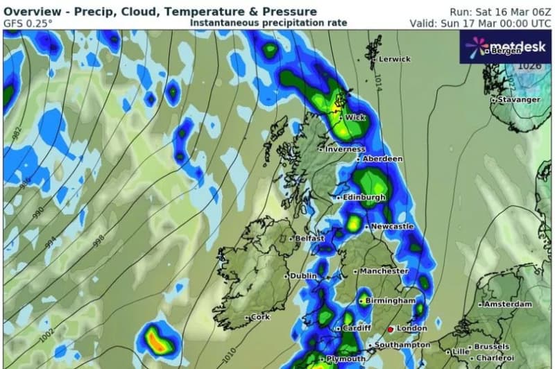
The models from WXCharts show a large front of heavy rain beginning to cover the entire length of the mainland UK late this evening, stretching from Cornwall up to the northern tip of Scotland.
Torrential downpours of 9mm per hour could be falling in south Wales and southwest England towards midnight, while areas in the far north could see snow instead.
After clearing to the eastern coast on Sunday morning, a second stormy weather front will then move in throughout the day, leaving many parts of the country drenched.
Things are only expected to clear for a few hours on Monday, with yet another round of wet, windy conditions coming to northern areas later in the day. It comes as a prolonged period of rain has left river and groundwater levels higher than usual in many parts of the country, leading the Environment Agency to raise the alarm over possible flooding.
A total of 15 flood warnings and 85 flood alerts remained in place on Saturday afternoon, and the risk could last well into next week. The Environment Agency's latest flood forecast reads: "Local flooding is probable from groundwater during the next five days in parts of the South of England. Local flooding is possible but not expected from surface water and rivers in parts of the South of England and the Midlands on Sunday. Lands, roads and some properties could flood and there could be travel disruption."
Temperatures are meanwhile expected to stay relatively mild this weekend and over the next few days, although a colder phase is expected to emerge mid-way through next week. Some overnights frosts are possible in the north. In his latest blog post for Netweather, forecaster Ian Simpson said: "It is looking probable that we will have a short-lived northerly blast next weekend, which will bring some colder and drier weather for a few days, with the potential for some wintry showers on high ground and in the north, followed by overnight frosts, so gardeners and farmers need to beware regarding possible plant and crop damage following faster than usual growth due to the recent mild and moist weather."