By Basten Gokkon
JAKARTA — Indonesia is rich in marine and fisheries resources, but how abundant are they exactly?
That’s the question a group of experts, led by Annisya Rosdiana from the Fisheries Resource Center of Indonesia (FRCI), an independent think tank with the Rekam Nusantara Foundation, seeks to answer as it works with the government to design what’s known as the country’s ocean account. This new scheme is part of the Ministry of Marine Affairs and Fisheries’ efforts to improve sustainable marine management and has been in development since 2021.
“We’ve become one of the most progressive [partners] in developing the ocean account in Indonesia as we’ve always been involved since the beginning,” Annisya said, adding that the FRCI’s participation in the initial discussions with other stakeholders eventually led to the think tank being appointed to oversee the mechanism for how Indonesia’s marine resources are accounted for and the implementation of pilot projects.
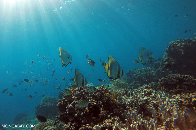
Marine life in Indonesia’s Komodo Islands National Park. Image by Rhett A. Butler/Mongabay.
Indonesia’s ocean account initiative — putting a monetary value on marine resources, ecosystem services and degradation trends over a given period of time — is also part of the Global Ocean Accounts Partnership (GOAP), an international collaboration with the goal of establishing globally accepted and standardized ocean accounting methods. The Norwegian Statistics Authority, a member of the GOAP, signed an agreement in May 2022 with the Indonesian fisheries ministry to collaborate on technical cooperation on marine accounting and long-term cooperation on statistics and research from 2024 to 2028.
Data deficiencies and gaps have been a key challenge to Indonesia’s efforts to make progress in managing its fisheries sector and achieving marine-related targets under the U.N.’s Sustainable Development Goals. Lack of coordination among related government agencies is another stumbling block. These have led to fisheries policies introduced by the central government being often met with weak enforcement on the ground and being poorly monitored and evaluated.
The fisheries ministry is developing two sets of tools — ocean accounting and ocean big data — to help inform government policymaking and zoning when it comes to the country’s fisheries, conservation areas and marine essential ecosystems such as seagrass meadows, mangrove forests and coral reefs.
“The easy way for me to understand it is like a balance sheet or records in accounting, a computation of the assets that we have,” said Heidi Retnoningtyas, Annisya’s team partner who also serves as FRCI’s ocean program director. “That’s how I associate ocean accounting.”
Annisya and Heidi spoke recently with Mongabay’s Basten Gokkon about Indonesia’s ocean account program, its progress and challenges to date, and ways to ensure the initiative benefits the country’s marine and fisheries resources. The following interview was lightly edited for clarity and flow.
Mongabay: How did your organization first get involved in the ocean account program?
Annisya Rosdiana: The fisheries ministry, specifically the conservation and marine biodiversity directorate, first brought forward ocean accounting to be implemented in supporting the management of conservation areas. Meanwhile, other ministries and agencies had drafted something similar to ocean accounting, but at a stage that’s not yet integrated. For example, the Ministry of Finance already had a valuation system for Indonesia’s natural resources. The statistics agency had for the past several years developed a system for environmental and economic accounts in Indonesia. However, these didn’t include marine resources; they were only touching on forest, water, land and mineral resources. The geospatial agency was also developing some kind of guideline in account drafting and valuation of the marine resources. In the meantime, the development planning agency had a need for data on marine biodiversity and ecosystem to support the implementation and achievement of the 2020-2024 National Medium-term Development Plan.
In September 2021, the first workshop took place where all of these institutions shared information and discussed how the ocean account could be developed together and, at that time, the Rekam Nusantara Foundation was involved in this discussion and also helped facilitate the event.
In 2022, we joined the GOAP, which is a platform where not only research agencies but also ministries and related institutions work together to execute resource development agendas. Rekam has received support from the GOAP in many activities, from planning and conducting workshops to producing road maps to implement the ocean account. Rekam was also involved in the piloting process of the ocean account, with the first projects in the Gili Islands [of West Nusa Tenggara province] and in Pantura [northern coast of Java Island]. Now, the pilot projects have been implemented in eight conservation areas.
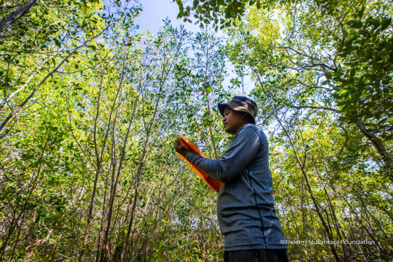
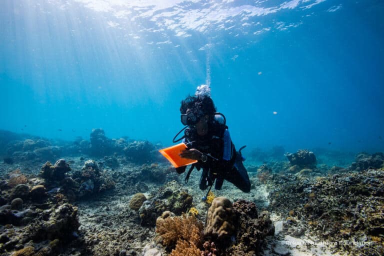
Indonesian research group Rekam Nusantara Foundation has been deeply involved in the development of the country’s ocean account since its inception. Image courtesy of Rekam Nusantara Foundation.
Mongabay: What is the scope of Indonesia’s ocean account?
Annisya Rosdiana: The ocean account is an integrated system to accumulate both spatial and nonspatial data. So, putting the data in the context of an ecosystem, we want to know exactly how much ecosystem assets we have, whether or not we have expansive mangroves, which fisheries resources exist, and what are the benefits. The ocean account will be able to integrate those data of ecosystems and services, including socioculture aspects.
The ocean account has several subaccounts. The first is the assets account, in which we include all kinds of assets that we have, their extent and amount, and their conditions: are they still good or damaged? And then those are translated into, for instance, monetary value. For example, with a given extent of mangroves, for the purpose of ecotourism, how much can be gained if we manage it? The ocean account also has a module called “flows to the economy” to describe how much benefit can be gained from those assets. On the other hand, how much can it affect the ecosystem? For example, how much trash or waste generated from tourism activities will flow to the ocean?
The statistics agency and the coordinating ministry of maritime affairs and investment are currently drafting the so-called maritime gross domestic product to identify how much revenue the state gets from the marine-fisheries sectors. But meanwhile, there’s a governance account, which means each marine space doesn’t have just one or two governance regimes, as they can also have conservation areas or shipping traffic or offshore lanes for oil and gas or cables, and so on.
With the ocean account, we can map out all of that and have it become a part of decision-making. This is also something that the fisheries ministry is working on, which is how permits in the seas can be monitored and simulated through the ocean account system, of which the information can give us a foundation for how a policy must be implemented.
Heidi Retnoningtyas: I joined in the middle of this process so I still have a lot to learn about what is included in the ocean account. The way I see it is that the ocean big data is part of the ocean account, because we can’t make any statements about the status of the assets that we have without the data. Since Indonesia is so big, certainly the data that we need should be just as big — from the size, the resources, the services provided by the marine ecosystem, the 11 fishing management areas, the marine protected areas — each of those have their own data on size, conditions, and so on. And right now we are in the process of collecting such data.
Indonesia is rich in marine ecosystems, such as mangroves and coral reefs, but how abundant are they exactly? Image by Rhett A. Butler/Mongabay.
Mongabay: Can you briefly describe the components in the ocean account?
Annissya Rosdiana: The first is the ecosystem asset account, which focuses on tabulating the assets that we have, both ecosystem assets such as mangroves, coral reefs, seagrasses, and individual assets such as fish resources, minerals. The second is the “flows to the economy,” which tabulates the economics of ecosystem assets. So, how much provisioning services can be harvested by certain sectors. There is a classification of sectors that utilize marine resources in Indonesia. The central statistics agency categorizes one of them into nine clusters including the fisheries cluster, biotechnology, marine services, marine tourism, defense, and industrial resilience.
The third account is “flows to the environment.” So, how much waste is generated from this sector to the environment. For example, water used for rinsing in the fisheries sector is discharged again into the environment, so how much is treated first, etc. So we can know how much each sector takes from nature, how much profit it makes, and how much it gives back to nature.
Then the fourth account is the marine economy or also called the satellite account. So we can know how much marine resources contribute to the national GDP, which is usually what the statistics agency does to find out the estimates of each of the nine clusters.
Then there’s the governance account. This is more about the combination of regulations in one given area, whether there are overlaps or intersections and so on, so that we can know more. Then the combination account. This is an accumulation of the previous accounts presented on the same display. The last account is marine wealth, which is more about the status of a country’s marine wealth.
Currently, Indonesia’s focus for implementation is on three accounts: ecosystem assets, flows to the economy, and flows to the environment. [Eventually all of the accounts will be implemented.] These have been piloted in several locations.
Mongabay: When the ocean account is completed, what do you expect to happen afterward?
Annisya Rosdiana: This should be the initial stage in both policy formulation and policy implementation. Policies must be based on scientific principles or what we call science-based management. Establishing sustainable management can be supported by the availability of data and information. So, in my opinion, the existence of this ocean account can strengthen how a policy is implemented, including to measure whether a policy is effective and also produces positive outputs for both the economy and the resources. If we only work at the implementation level without having the tools to measure a successful policy, in my opinion this is ineffective, and this ocean account is one of the providers of information on how the policy should be designed and in the future how the policies should be implemented.
Heidi Retnoningtyas: From what I understand, for example shipping traffic, it’s not necessarily included in the data, but that’s described as one of the services provided by the marine ecosystem, that’s what’s accounted for. With our long coastline, hopefully that can be the basis for managing shipping traffic lanes, but the lanes themselves are not part of the account. As far as I know, there are clusters to identify an ecosystem service. Sometimes we are hampered by our capability to assess all those many clusters and that’s why we have picked priority or dominant clusters in certain areas.
Annisya Rosdiana: We know that there’s provisioning service, how an ecosystem provides material benefits for human life. And then there’s cultural service, how it provides a service for appreciating the beauty of nature, and tourism is part of that. The ocean account maps those out in two ways: first, how we identify the potentials of an ecosystem service, like tourism, and also how tourism can affect the ecosystem.
Now, this is one of the bases on how the ocean account can simulate the utilization of marine space. For example, if a company wants to build a tourism development somewhere, it can be simulated what ecosystem assets that development has, approximately how much tourist [infrastructure] can be created, then the impact in the future if they utilize a certain size of the area, then how much economic benefits can be generated. That is one form of simulation. Because by knowing the assets we have and then also what the changes might look like, whether or not the assets can be recovered, it becomes one of the considerations in determining the utilization of marine spaces.
Regarding defense and security, we look more at what are the defense and security activities in an area. For example, last year there was a survey in Anambas [an archipelago off eastern Sumatra], we found that there were several activities such as patrols or monitoring in the border area, and this is also related to defense and security. This means that we can also see the role of marine resources is very important in the context of defense and security because this can be one of the barriers for us to protect our country from various threats from outside. And how this effort can also be done including to protect the resources that we have. There is a kind of interaction between the defense and security process and the sustainability of resources, besides which the existence of resources is an important asset for defense and security. That is what we map economically or we estimate how much area is used for defense and security. How does this defense and security activity also affect the ecosystem, for example, whether there is waste produced, and so on.
Mongabay: Is that also applicable for coastal mining and development?
Heidi Retnoningtyas: Yes, that’s one of the things assessed. When mining activities are quite dominant in a certain area, that becomes an important note. These activities create economic impacts for the locals and surrounding communities and also the nation, but they also create environmental impacts. That becomes an input for the ocean account.
Annisya Rosdiana: The ocean account can help serve as a barometer for how much utilization we have done. Are our assets still adequate for future utilization? There’s a quite unique analogy by Professor Ahmad Fauzi, one of the experts on Indonesia’s ocean account, who said that we can check via ATM the amount of money we have in our bank account, and that tells us how much we can withdraw so that there’s still enough for next month. That’s one of the benefits of the ocean account.
Mongabay: Specifically related to resolving conflicts in marine and coastal territories, how do you see the ocean account contribute to that?
Annisya Rosdiana: In terms of scientific evidence, we should be able to answer that. Of course, when we have a complete monitoring base or at least we have a continuous monitoring base over years, for example, we can find out what the trend of change of a marine area is like, whether it occurs naturally or as a result of inappropriate spatial utilization. And this can also be a proxy for the future, for example, if we want to apply a certain type of spatial utilization, whether in the future there will be conflicts or damage and losses, and how much mitigation costs we need to prepare. By knowing the assets and trends of change of an area, especially in the sea with the ocean account approach, this becomes very possible. And that is also what the fisheries ministry is developing, how with a dynamic system approach which is then combined with information on marine resource assets, how much economic valuation [is generated]. Then zoning data is combined or overlapped in the same database, and we just need to input data, for example, what kind of utilization of marine space we plan to simulate, so that we can estimate the impact in the next 10-20 years on the ecosystem. And that is very possible to do.
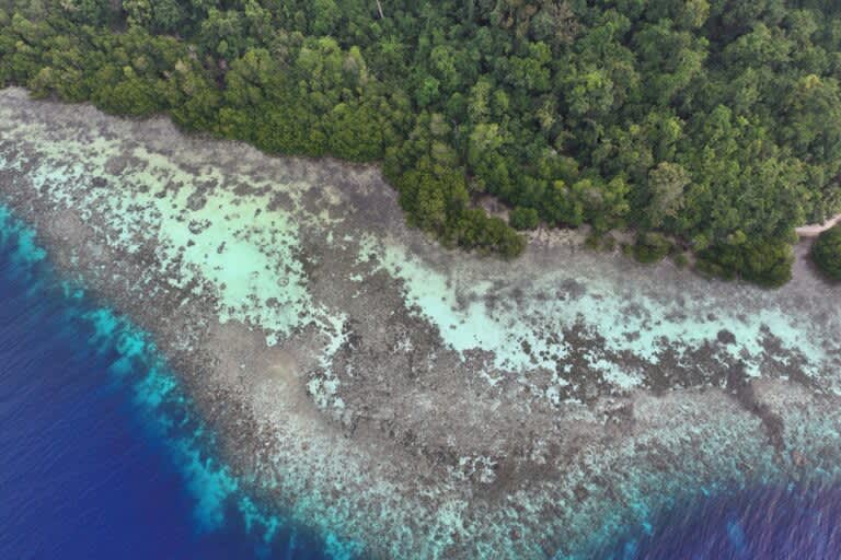
The Gili Islands near the tourist hotspot of Bali have been selected as one of the pilot projects for Indonesia’s ocean account program. Image courtesy of Rekam Nusantara Foundation.
Mongabay: What are the challenges you face in developing the ocean account?
Heidi Retnoningtyas: The main challenge is obviously the vastness of Indonesia, as far as I can see, because with the vastness of the territory and the large number of stakeholders — which can actually be used as an opportunity as well, even though there are often many — the capacity is different. So far we still tend to rely on teams from the central government to survey and collect data. So, the first challenge I see is the vastness of the area and the amount of data that must be collected. The second challenge is the coordination of cooperation between stakeholders that must always be strengthened. That’s why we are grateful that one of the activity items funded by the ocean account project is the strengthening of the working group, because without it we don’t have spare funds to hold regular meetings.
Annisya Rosdiana: From the capacity aspect in Indonesia itself, this is still a challenge because we also actually follow the ocean accounting technical guidance issued by the GOAP. But in practice, it is all left to us because we’re the ones who understand best the vast context of resources in Indonesia. This [limited] capacity has been highlighted on various occasions, including how we monitor the condition of the ecosystem and also the socioeconomic aspects and utilization. We periodically conduct joint piloting between institutions and joint studies. There are several outcomes that have been produced both through piloting and case by case, such as compiling the value of marine resources in Indonesia. Then there are also methodological standards. There are many technical and nontechnical complexities, including how the results of the ocean account can support existing policies or vice versa, how these policies can provide opportunities for the ocean account to be implemented. This is still a challenge.
Mongabay: What are the factors that ensure the ocean account will be optimal in its role to improve the sustainable management of Indonesia’s marine ecosystem and fisheries?
Annisya Rosdiana: When we talk about sustainable development goals at the global level, which have been embodied in the national development plan and related regulations, of course a comprehensive approach like this is one of the keys to realizing these targets. Then in the technical process of the ocean account, we use up-to-date systems and technologies, for example, in mapping marine resources we use satellite imagery that is updated in real time and we can get it regularly. This geoportal system is also one of the keys [to ensuring] that the ocean account is built with a reliable process and is equipped with monitoring that has been carried out by the community and institutions of an area. And the next thing we learned is that Indonesia’s ocean account is compiled by cooperation between stakeholders. Maybe in other countries only universities initiate their ocean account, so their approach may be more scientific. In Indonesia, we have a greater opportunity because ministries, institutions, campuses and communities can also participate in the preparation, so this is not only in support of science but also in support of policies.
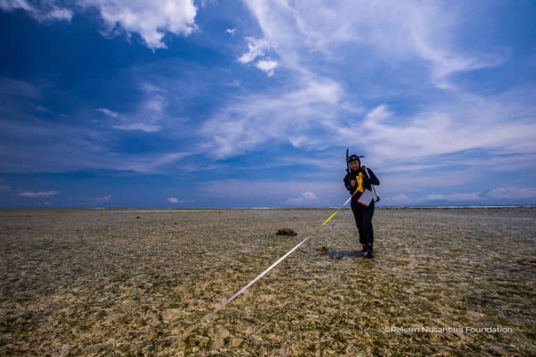
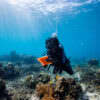
Data deficiencies and gaps are the main challenges to Indonesia’s efforts to make progress in managing the fisheries sector and achieving marine-related SDGs targets. Image courtesy of Rekam Nusantara Foundation.
Basten Gokkon is a senior staff writer for Indonesia at Mongabay. Find him on 𝕏 @bgokkon.
See related from this reporter:
FEEDBACK: Use this form to send a message to the author of this post. If you want to post a public comment, you can do that at the bottom of the page.
This article was originally published on Mongabay