Keep those sweatshirts and extra blankets handy because our frigid April mornings aren’t finished with us yet.
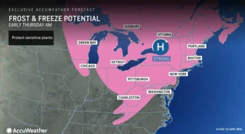
Forecasters say New Jersey will wake up to two more unseasonably cold mornings this week, with a risk of frost that could damage sensitive outdoor plants as temperature drop near and below the freezing mark again on Thursday morning and Friday morning.
In between those days, the Garden State will be basking in mostly sunny skies on Tuesday, with afternoon highs reaching the mid-60s, followed by cloudy skies and occasional rain showers on Wednesday as a cold front moves in from the west, according to the National Weather Service and AccuWeather.
Forecasters from AccuWeather say wide regions of New Jersey, along with other eastern states, face the possibility of frost and freeze conditions late Wednesday into early Thursday and again late Thursday into early Friday.
Elevated risk of wildfires
Although the warm and dry conditions on Tuesday will be great for outdoor activities, the weather service is concerned about an increased threat of wildfires because of the low humidity, dry brush and occasional gusty winds in the afternoon and early evening.
“Residents are urged to exercise caution handling any potential ignition source, including machinery, cigarettes and matches,” the weather service said in a special weather statement issued Tuesday morning. “Be sure to properly discard all smoking materials. Any dry grasses and tree litter that ignite will have the potential to spread quickly.”
Elevated fire alerts were issued in all of the state’s 21 counties, effective until 6 p.m. Tuesday in most counties and until 8 p.m. Tuesday and in Bergen, Essex, Hudson, Passaic and Union.
Coldest towns Tuesday morning
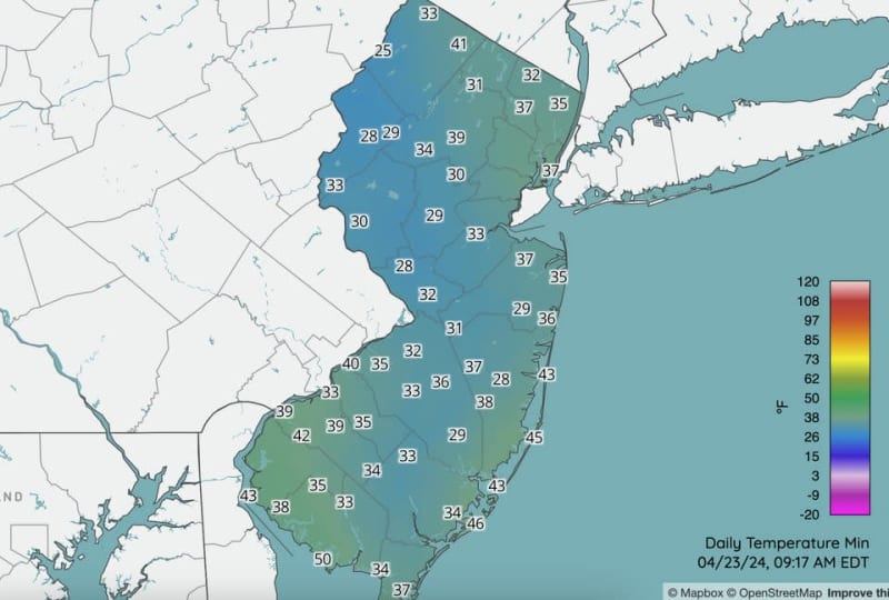
Although no records were broken, temperatures in some areas of New Jersey dropped as low as the mid- to upper 20s Tuesday morning, making it feel more like late winter than early spring. These were the coldest lows reported by the Rutgers NJ Weather Network and the National Weather Service:
- 25° in Walpack, Sussex County
- 27° in Sandyston, Sussex County
- 28° in Berkeley Twp., Ocean County
- 28° in Hopewell Twp., Mercer County
- 28° in Oxford, Warren County
- 28° in Toms River, Ocean County
- 29° in Hackettstown, Warren County
- 29° in Hillsborough, Somerset County
- 29° in Howell, Monmouth County
- 29° in Lakehurst, Ocean County
- 29° in Oswego Lake, Burlington County
- 29° at Sussex Airport, Sussex County
Based on historical averages, morning lows in late April should range from 39 to 40 degrees in northwestern New Jersey, to the mid-40s in northeastern New Jersey and 44 to 45 degrees in central and southern New Jersey. Afternoon highs are normally in the mid-60s this time of year.
Current weather radar

Thank you for relying on us to provide the local weather news you can trust. Please consider supporting NJ.com with a voluntary subscription.
Len Melisurgo may be reached at LMelisurgo@njadvancemedia.com or on X at @LensReality.