Soaring temperatures and bone-dry mountain winds threaten to set parts of the US ablaze triggering a raft of ‘red-flag’ wildfire warnings.
A surge of heat from the Gulf of Mexico this week could push the mercury to 100F across southern states.
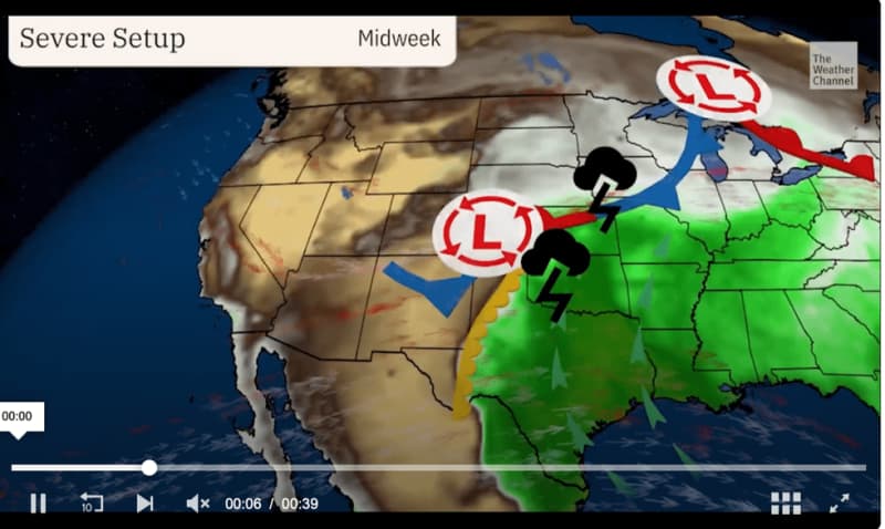
Dry winds tumbling over mountains –lee cyclogenesis– creating a tinderbox will raise a "critical risk of fires", according to the National Weather Service (NOAA).
A spokesman said: “A strong southerly flow into the Plains will promote warming across the region over the next few days.
“There is a critical fire potential over portions of the southern High Plains.
“Lee cyclogenesis will contribute to dry and windy conditions across portions of the Southwest and Southern High Plains, which will support a Critical Risk of fires.”
Low humidity will bring an addition fire risk to some northern states including Montana, North Dakota and Colorado.
Red-flag warnings are in force across three states with further alerts likely ahead of the weekend.
Humidity is forecast to dip to 11 per cent which with rising temperatures will spark ideal conditions for wildfires.
The NOAA spokesman added: “A fire weather watch remains in effect from Wednesday afternoon through Wednesday evening for gusty winds and low relative humidity.
LATEST DEVELOPMENTS:
“A Fire Weather Watch means that critical fire weather conditions are forecast to occur.”
It is the latest twist in a run of extreme weather which has seen the US beset by storms through the past month.
Away from the fire zones, parts of the country including the Mississippi Valley and Great Plains remain on flood alert.
To the northwest, a last tickle of winter pushing temperatures close to zero will bring snow over high ground.
Heat surging from the south clashing with the remains of winter cold to the north have destabilised the atmosphere and fired-up the jet stream.
Jim Dale, meteorologist for British Weather Services and co-author of ‘Surviving Extreme Weather’, said: “The main issues are still the growing heat to the south of the country and the instability this causes when it hits cooler air from the north.
“This is going to keep the risk of storms and tornadoes, some of which could be powerful and stretch beyond the usual tornado alley region where they are most prone.
“Frontal systems coming through during the rest of the week will bring more very unsettled weather, and where it is cooler to the north, there may be a dusting of snow over the mountains.”
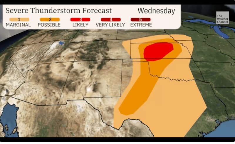
The Weather Channel warned the ‘storm weary’ to brace for another blast of disruptive winds, rain and giant hail.
Meteorologist Chris Dolce said: “Ingredients are coming together for storms, and tornadoes, large hail, strong winds and flash flooding are all concerns.
“Many areas that were devastated by last weekend’s tornadoes could see more storms this week.
“Storms capable of producing hail larger than the size of golf balls, wind damage and a few tornadoes will be possible from southeast Nebraska to much of Kansas, western Oklahoma and western parts of Texas.”