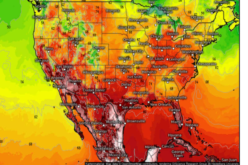
A record heatwave roasting Mexico will surge northwards pushing temperatures in parts of America to ‘danger’ level.
Swaths of the United States will boil as a plume of tropical heat thrusts the mercury past the 100F-mark.
Central and north-western regions will feel first the lick of the flame before the burner turns southwards later this week.
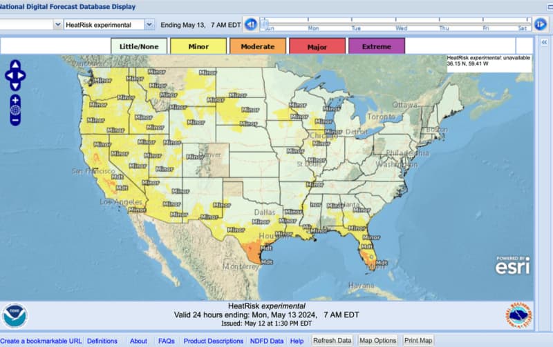
The National Weather Service (NOAA) warns of a ‘moderate’ to ‘major’ risk in parts of Texas and Florida its heat index points to ‘dangerous’.
A sweltering plume will sweep in from Mexico which last week recorded its highest temperature of 51.1C in Gallinas.
Jim Dale, US weather correspondent and meteorologist for British Weather Services, said: “We have seen record heat in Mexico with temperatures off the scale in parts of the region at the end of last week.
“Now, this heat is spreading into the United States, and I wouldn’t be surprised to see this heat cross the border into southern states.
“It will be the south of the country that will get the highest temperatures before it eases a bit after this week.”
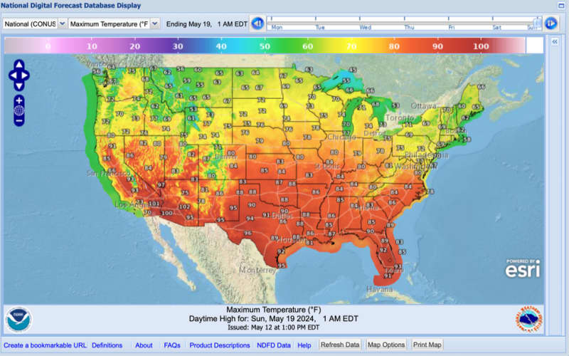
Temperatures across the Pacific northwest and northern tier at the start of the week will be around 10F to 20F above average for mid-May, according to weather models.
Later in the week, thermometers across southern states will rocket to between 80F and just above 100F.
LATEST DEVELOPMENTS:
After a relatively settled weekend, raging heat and humidity will kick-off another bout of thunderstorms, experts warn.
A spokesman for the NOAA said: “Well above-average temperatures are expected throughout the West and north-central United States, and summer-like temperature will continue across much of the West and north-central US with well-above average highs in the 70Fs and 80Fs, and potentially in the lower 90Fs for some.
“Active weather is forecast in the southern US over the next few days as a low-pressure system sweeps across the south into the southeast.”
Heavy rain will bring a risk of flooding in Texas, the Lower Mississippi Valley, and Louisiana, it warned.
It comes amid fresh warnings that the US could be facing an unusually fierce hurricane season.
El Nino, a warming of the South-American Pacific which set in last year, is fading into a La Nina cooling event.
This threatens to supercharge the 2024 hurricane season which could fire up as early as next month.
Weather Channel meteorologist Jonathan Erdman said: “In another month, El Nino could be gone, and according to a government outlook, La Nina is expected at some time during the summer.
“That may have important ramifications on the 2024 hurricane season and next winter.”
Weather patterns could be given a shake-up by fluctuating ocean temperatures with the Caribbean Sea and Gulf of Mexico likely to be particularly volatile.
Mr Erdman said: “There could be an increased chance of a hotter summer in the central and eastern United States, with a warmer, drier winter in the south, a colder winter in the Northern Plains and a wetter winter in the Pacific northwest.”
Pockets of cooler than average water have been recorded along the equator, he added, making La Nina more likely.