The Memorial Day Weekend weather outlook includes summer-like temperatures in some areas of the state, cool breezes at the shore and a chance of strong thunderstorms later in the weekend.
The National Weather Service in Mount Holly is forecasting highs in the upper 80s across most of the southwestern area of south jersey up to the southern edge of Morris County and increasing humidity Saturday that could lead to evening showers.
Areas east of the I-95 corridor get some relief from high temperatures with forecasters predicting highs in the mid-70s from Cape May to Sandy Hook.
Scattered showers could develop later Saturday north and west of Philadelphia and sweep across New Jersey in the evening, forecasters say.
Sunday’s highs ease a little with pockets of mid-80s temperatures in northwestern Camden and Burlington Counties, according to the National Weather Service. Eighty-degree temperatures will reach all the way up into Sussex County as well, and the shore areas will see a slight drop in temperatures into the low-70s.
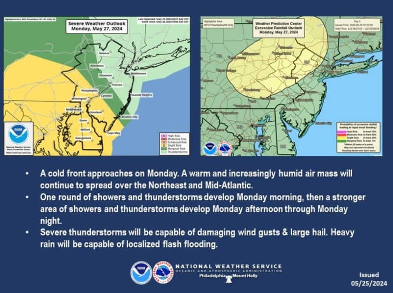
Monday’s forecast has the greatest chance of rain with the possibility of several rounds of showers and thunderstorms, according to forecasters at the National Weather Service. Forecasters said Saturday morning that the first round could hit the Garden State in the morning with the potential for more storms in the evening.
The evening storms are expected to be stronger with gusty winds and the potential for hail and flash flooding, the National Weather Service said.
Strong storms raked across areas of New Jersey on Thursday knocking out power for thousands of residents in the northern coastal areas.
Our journalism needs your support. Please subscribe today to NJ.com.
Matthew Enuco may be reached at Menuco@njadvancemedia.com. Follow Matt on X