The Met Office has forecast “cool and damp” conditions for much of the UK as an area of low pressure is set to approach from the west.
Britain’s national forecaster suggested that as the low pressure zone approaches, slow-moving thunderstorms could form bringing heavy rain.
However, the forecaster suggested that “not everywhere will catch a shower” and many parts of the UK could still hold onto some “warm, sunny days”.
When asked about the band of low pressure, approaching from the west, a Met Office spokesperson told GB News: “A new area of low pressure will approach from the west later in the end, and it is likely to remain changeable into next weekend.”
For those who are worried about missing out on the sunshine, the spokesperson added: “Cool conditions will affect much of the country, but never the less given we are a few weeks from high summer when the sun is at is strongest, it will still feel pleasant in sunshine, especially where winds fall light.”
According to the Met Office outlook for Tuesday to Thursday this coming week, Britain is expected to receive a “mixture of sunny spells and showers”.
It read: “Staying cool with a mixture of sunny spells and showers over the next few days. Showers turning lighter by Thursday, before an organised band of cloud and rain arrives Thursday.”
Looking beyond the mid-week and into the following weekend, the Met Office said there was a chance of high pressure taking control and bringing warmer weather.
LATEST DEVELOPMENTS:
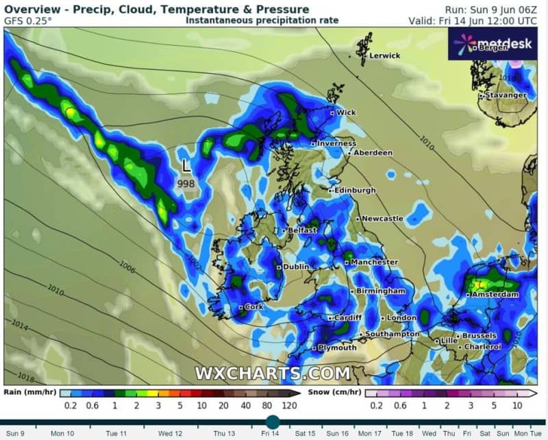
In their long-range forecast for June 13 to June 22, the Met Office said: “After a dry start for many on Thursday, a band of rain is expected to push eastwards to affect much of the country.
“It will feel cool and damp for many, especially across hills in southern and central areas. On Friday and over the weekend, the weather will likely become a mix of sunshine and showers.
“During the daytime on each day, showers could become heavy and slow moving, and there is a chance these might turn thundery at times.
“However, not everywhere will catch a shower, and many places may hold on to warm, sunny days with light winds.
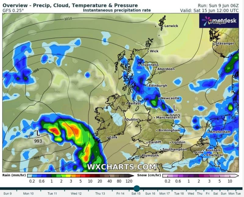
“Next week, confidence for dominant weather regimes is low. There are tentative signs of building high pressure from the west, but rain and showers are still possible.”
Looking only a bit ahead to Sunday night and going into Monday, a cold mass of air is likely to drive temperatures down to single digits and could bring some “frost” according to the forecaster.
Giving a prediction for GB News, Met Office forecaster Ellie Glaisyer said: “It's those cloudy conditions across England and Wales that will give some milder temperatures overnight.
“Maybe 11C or 12C in the south under the clearer spells across parts of Scotland and Northern Ireland.
“Perhaps quite a chilly start in places, maybe some grass frost as well.
“But further south, that cloudy and damp start to the new working week.
“This could give some tricky driving conditions and perhaps some disruption through the morning rush hour on Monday.
“But further west across parts of Wales, Northern Ireland and northwestern parts of England, it'll be a bit of a dry and brighter start to the day.
“A chilly start in places across parts of Scotland, but quite quickly replaced by heavy and blustery showers pushing in through the north through the early hours of the morning.
“Through the rest of Monday, those showers will continue across parts of Scotland, slowly pushing their way southwards as that area of rain across eastern parts of England pushes away towards the southeast.”