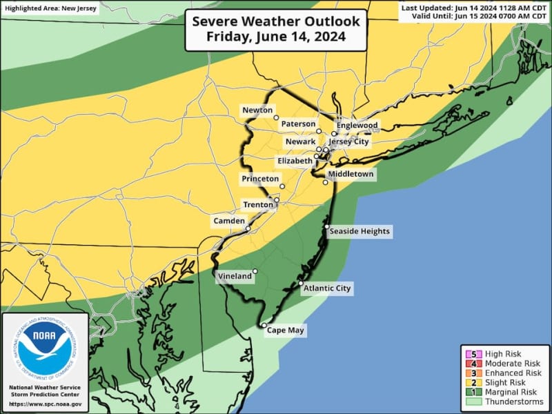
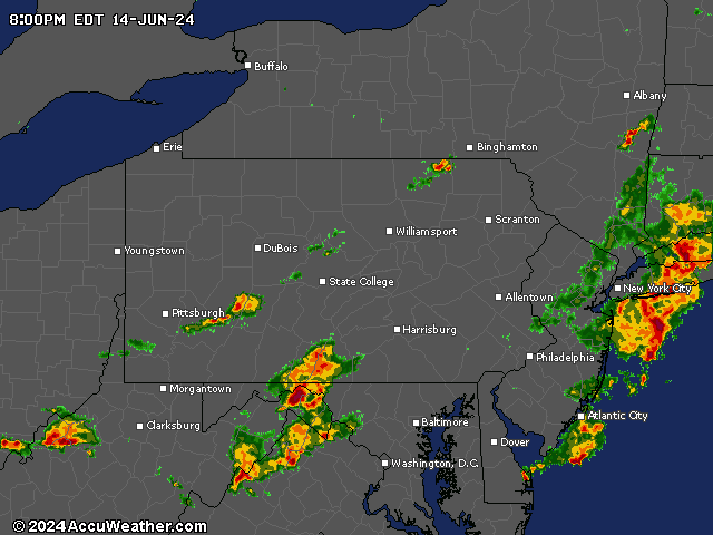
Strong thunderstorms are sweeping across eastern Pennsylvania and making their way into parts of New Jersey Friday afternoon, prompting severe thunderstorm warnings to be issued in several counties.
Forecasters say storm cells triggered by a cold front are packing heavy downpours, pea-sized hail and wind gusts up to 60 mph, which are strong enough to knock down trees and power lines.
ALSO: Live N.J. power outage tracker: Thunderstorms cut power to thousands of homes
At about 4:15 p.m., the National Weather Service issued a severe thunderstorm warning for Sussex and Warren counties in northern New Jersey, effective through 5 p.m. Friday. Another severe thunderstorm warning was issued at 4:40 p.m. for west-central sections of Hunterdon County and the southwestern region of Warren County, effective until 5:30 p.m.
Additional warnings are possible during the next few hours, with more thunderstorm cells expected to develop as the cold front clashes with hot and humid air in the atmosphere, forecasters say.
UPDATE: New thunderstorm warnings have been posted for Bergen, Hunterdon, Middlesex, Morris, Passaic and Somerset counties, effective until 6:15 p.m. in some areas and 6:45 p.m. in others. (see more details below)
Temperatures in some parts of the state — including Cherry Hill in Camden County and Hillsborough in Somerset County — soared to the upper 80s early Friday afternoon, and some spots climbed into the low 90s later in the afternoon, adding more fuel to the thunderstorms that form.
The thunderstorms are expected to ease up Friday night, from west to east, followed by what’s expected to be a dry and quiet weekend in New Jersey.
Mostly sunny skies and low humidity levels are forecast for both Saturday and Sunday, when Father’s Day will be celebrated. Afternoon temperatures should rise into the low to mid-80s. After that, however, the first heat wave of the year is expected to hit New Jersey, with temperatures likely to climb into the low 90s Monday and Tuesday, then making a run for the mid-90s on Wednesday and Thursday.
On top of the steamy temperatures next week, humidity levels will be creeping up, making it feel even hotter outside, forecasters said.
Latest storm alerts in New Jersey
Current weather radar
Thank you for relying on us to provide the local weather news you can trust. Please consider supporting NJ.com with a voluntary subscription.
Len Melisurgo may be reached at LMelisurgo@njadvancemedia.com or on X at @LensReality.