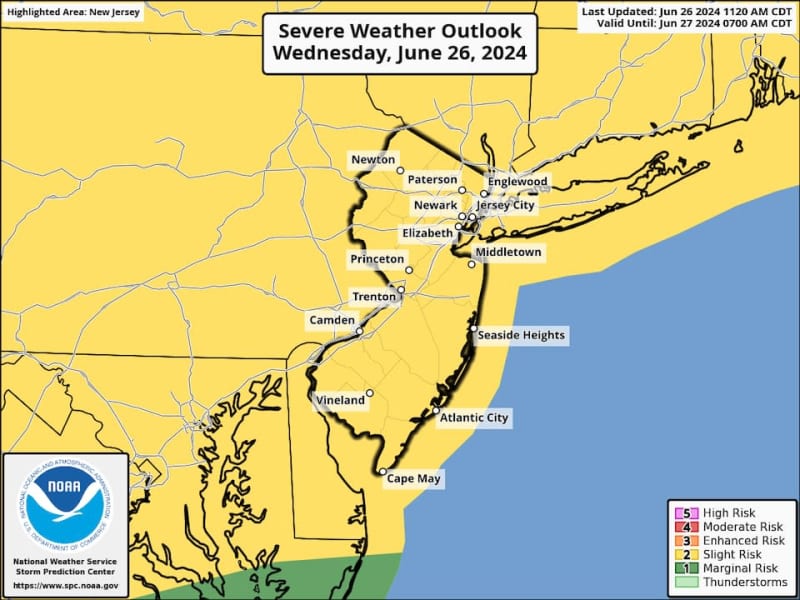
For the second time in four days, a severe thunderstorm watch has been issued in New Jersey because of the threat of strong thunderstorms that could generate damaging winds, large hail and even some small tornadoes.
The watch, which is not as urgent as a warning, covers 17 counties in the Garden State and will be effective from 6:15 p.m. Wednesday through 12 a.m. Thursday.
The counties under the the watch were Bergen, Burlington, Camden, Essex, Gloucester, Hudson, Hunterdon, Mercer, Middlesex, Monmouth, Morris, Ocean, Passaic, Somerset, Sussex, Union and Warren counties.
The National Weather Service says a strong cold front will move across our region, setting the stage for scattered thunderstorms that could become intense because of the energy from the 90-degree temperatures and high humidity.
Forecasters from the Storm Prediction Center, affiliated with the National Weather Service, say there’s a 15% to 30% chance of severe winds and a 5% to 15% chance of significant hail occurring in any part of the Garden State on Wednesday.
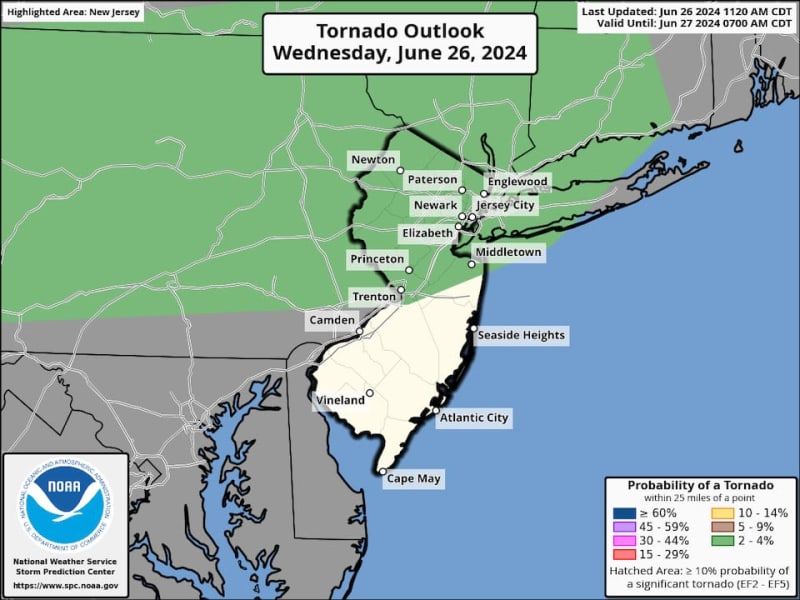
Although the threat of isolated tornadoes is fairly low — with a 2% to 4% probability — they can’t be ruled out, especially in the northern half of the Garden State, as well as most of Pennsylvania, New York City and Long Island, N.Y., according to the Storm Prediction Center.
A severe thunderstorm watch puts the public on alert that strong storms with winds capable of knocking down trees and power lines, or causing structural damage, could be on the way.
Prior to the thunderstorms, temperatures are expected to soar into the low to mid-90s in interior sections of New Jersey, with high humidity making it feel even hotter.
Current weather radar
Thank you for relying on us to provide the local weather news you can trust. Please consider supporting NJ.com with a voluntary subscription.
Len Melisurgo may be reached at LMelisurgo@njadvancemedia.com or on X at @LensReality.