Space photos of Mount Fuji
Mount Fuji stands standing at 3,776 meters (12,389 feet). It’s is Japan’s highest and most iconic peak, as well as a vital part of both natural and spiritual heritage. Its snow-capped summit can be seen from great distances, offering a breathtaking view that has inspired countless works of art and literature.
Apparently, it can also be seen from outer space.
The advent of advanced space technology has made it possible to observe Mount Fuji from a vantage point previously unimaginable – the International Space Station (ISS).
The ISS orbits the Earth at an altitude of approximately 400 kilometers (248 miles), providing astronauts with a unique perspective of our planet. Equipped with powerful cameras and lenses, they capture stunning images of Earth’s natural wonders, including Mount Fuji.
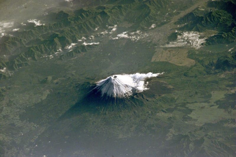
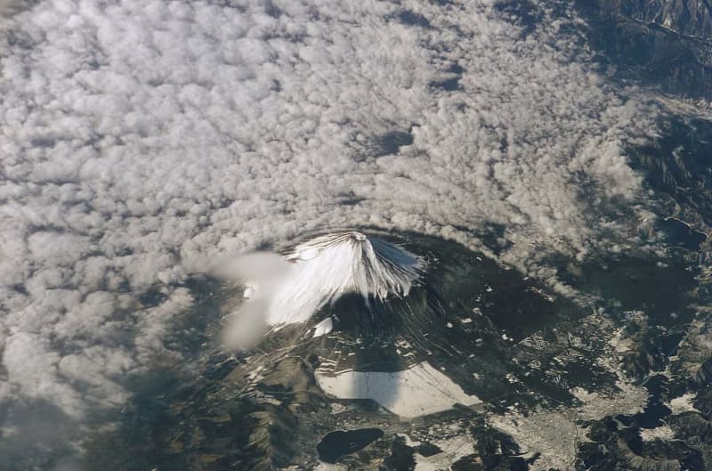
Astronauts aboard the ISS need oblique views and low sun angles to capture the three-dimensional essence of landscapes. This technique is crucial for photographing mountainous regions, as it emphasizes the topographical features that might otherwise appear flat.
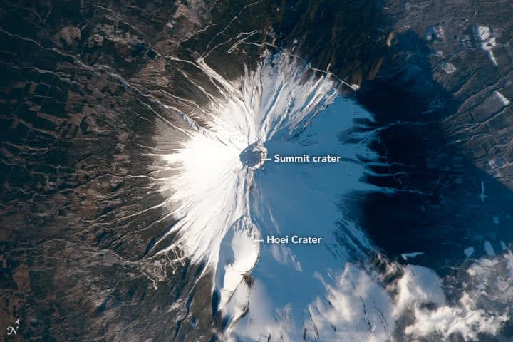
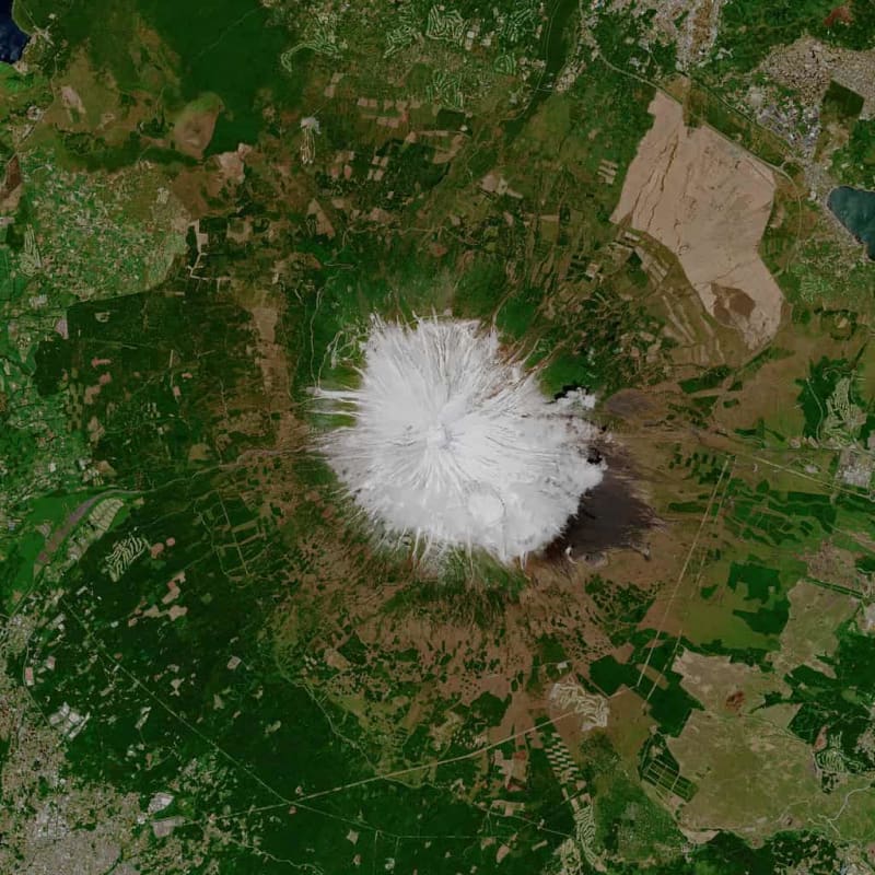
A notable photograph of Mount Fuji was taken with the most powerful lens on the ISS, showcasing the volcano’s conical shape under the low afternoon sun. This lighting highlights the numerous gullies on the flanks and the shadows cast within the summit and side crater, known as Hoei. Some images, taken from shuttles, provide a different perspective of Mount Fuji, further enhancing the sense of topography. Others, taken right above, make it seem almost flat.
The geology of Mount Fuji
This majestic mountain is a volcano. It’s a stratovolcano, a type of volcano characterized by its layered structure built up over time through a series of eruptions. Its geological history is complex, spanning thousands of years and involving multiple stages of volcanic activity.
Mount Fuji has experienced numerous eruptions throughout its history, with the most significant ones leaving a profound impact on its shape and surrounding environment. The most recent major eruption occurred in 1707-1708 during the Edo period, known as the Hoei Eruption. This eruption deposited large amounts of ash and pumice, creating a secondary crater on the southeast flank, known as Hoei-zan.
Mount Fuji is located near the convergent boundary of the Eurasian, Philippine Sea, and Pacific tectonic plates, making it a region of significant seismic activity. Earthquakes and volcanic tremors are common, indicating ongoing subterranean movements. Monitoring these seismic activities is crucial for predicting future eruptions and ensuring the safety of the surrounding populations.
Today, Mount Fuji is classified as an active volcano, with the potential for future eruptions. Japanese authorities closely monitor the volcano using a network of seismographs, GPS sensors, and other geophysical instruments. This monitoring is vital for early warning systems and for mitigating the impact of any future volcanic events.
Was this helpful?
Thanks for your feedback!
This story originally appeared on ZME Science. Want to get smarter every day? Subscribe to our newsletter and stay ahead with the latest science news.