A trio of cyclonic weather systems will drive an Arctic chill across Britain before unleashing an autumnal soaking.
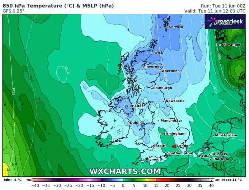
Northerly winds through the coming days will make it feel ‘more like March’ with much of the country braced for rain.
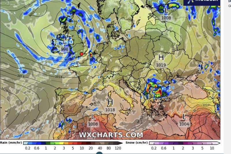
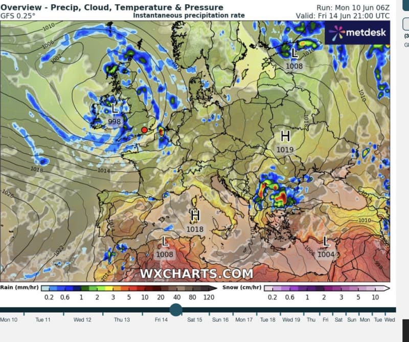
Britain’s weather at first will be dominated by low pressure and Arctic winds before a pattern change delivers a weekend deluge.
Temperatures will limp upwards with Friday to be the ‘warmest’ day of the week at a lacklustre 20C.
Met Office meteorologist Alex Deakin said: “At times it might look like the middle of June, but for most of this week it won’t feel like the middle of June.
“Across the board, we are below average and, in some places, quite a bit below, feeling more like March with those northerly winds.
“Temperatures are ticking up on Friday which could potentially be the warmest day of the week at 16C, 17C, 18C, 19C or maybe a 20C between the showers.
“But with the showers it still isn’t going to feel particularly warm.”
Britain will be sandwiched until mid-week between high and low pressure funnelling winds in from the Arctic.
High pressure–the driver of warmer, more settled weather–will win out on Wednesday, Deakin said.
However, another barrage of rain from the Atlantic will kick off through the second half of the week, he warned.
He said: “We see a significant change from the middle of the week the high pressure topples away and weather fronts come swinging in from the Atlantic.
“That will change the wind direction at least, but those weather fronts will bring outbreaks of rain and as we go into Friday, low pressure really moves in and this one is really going to sit around.”
Three separate low-pressure systems are the villains behind Britain’s autumnal outlook, experts say.
High pressure, the driver of summer sunshine and warmth, has been noticeably absent through spring and the start of summer.
As June squelches towards the mid-month mark, experts warn there is ‘no sign’ of an major turnaround.
Jim Dale, meteorologist for British Weather Services and social commentator, said: “There are three low pressure systems that are going to impact the weather through the week.
“So, it is going to stay cool, certainly through the start of the week and there will be a risk of showers.
“Some of these could be heavy, with Scotland, Northern Ireland and north-west England being the main recipients.”
Heavy downpours and powerful thunderstorms in parts will bring a risk of flooding, he warned.
He said: “There is a lot of energy in the atmosphere, and this will bring the risk of thunderstorms and flooding where they happen.
“As soon as we lose the wind, humidity will rise, and this will raise the risk, so we could see some pretty decent thunderstorms.”
Wednesday will be the best day of the week with less risk of rain and temperatures on the rise.
Deakin said: “High pressure tries to topple in, and Wednesday does look like a pretty good day under a ridge of high pressure.
“The winds won’t be as strong, but there will be a noticeable breeze across the northeast of Scotland with a few showers.
“Many places will be dry with some fine weather in the west.”