Many U.S. states, including New Jersey, have been sizzling this week and will continue to be steamy throughout the weekend thanks to a massive “heat dome” that’s covering a large chunk of the nation.
In case you didn’t study meteorology and are wondering what a heat dome is, here’s the answer.
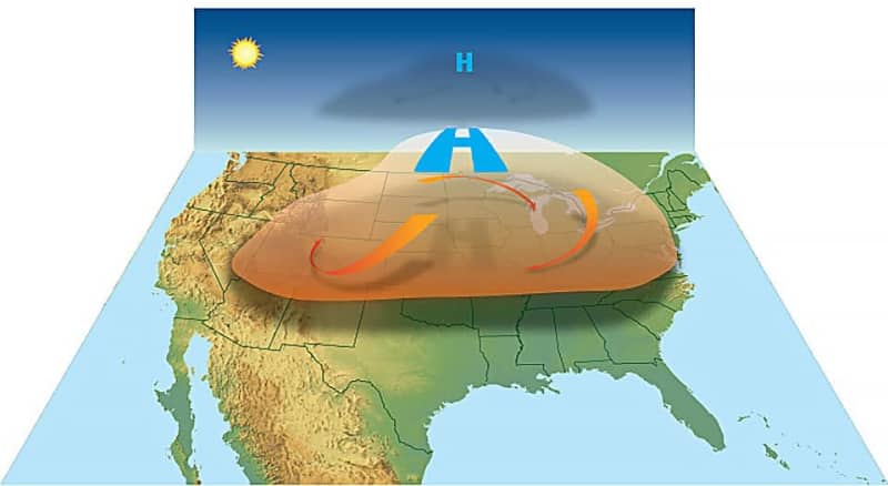
A heat dome occurs “when the atmosphere traps hot air like a lid or cap” over a specific region, according to the National Oceanic and Atmospheric Administration, better known as NOAA.
It’s basically a large, persistent dome of high pressure, which is nothing unusual during the summer months, especially in places like the southwestern region of the U.S., the Washington Post notes.
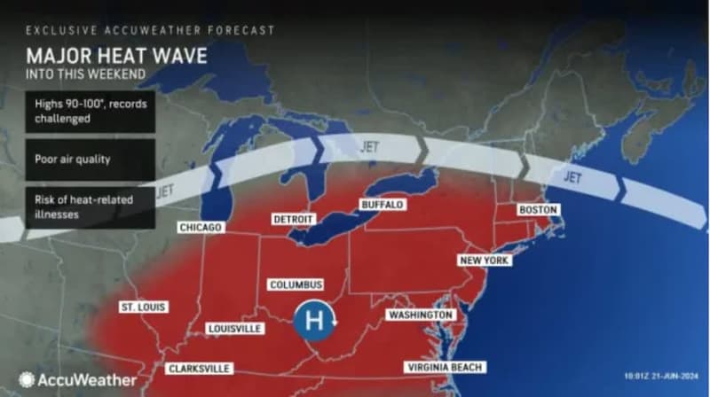
However, the heat dome that’s been responsible for this week’s hot weather is a little different because it is generating intense triple-digit temperatures in some parts of the U.S. and is impacting a wide swath of the eastern half of the nation, roughly from the Great Plains states up through Maine in the Northeast and down to the Mid-Atlantic region.
Is a heat dome a heat wave?
Experts say it’s helpful to think of a heat dome as what’s happening up in the atmosphere. A heat wave is how the hot temperatures affect people on the ground, said Ken Kunkel, a research professor of atmospheric sciences at North Carolina State University.
When a high-pressure system develops in the upper atmosphere, it causes the air below it to sink and compress. That raises temperatures in the lower atmosphere.
Because hot air expands, it creates a bulging dome.
The boundaries of this week’s heat dome are not well-defined, Kunkel said, but the National Weather Service has said the most extreme heat is expected in the Ohio Valley and the Northeast regions.
The eastern heat dome follows an earlier-than-usual heat dome this month in the Southwest.

What is a heat wave?
A heat wave is defined by how intense the heat is, how long it lasts and where it occurs, said Jeff Masters, a meteorologist with Yale Climate Connections.
In general, several days of 90-plus degree temperatures in Texas are “no big deal,” Masters said. But farther north, it was forecasted to be in the mid- to high 90s over the Midwest and Northeast this week and this weekend, with the heat index — how hot it feels when humidity is factored in — reaching the upper 90s to 100 degrees or even higher in some areas.
“The population’s just not conditioned to that sort of heat,” Masters said.
The National Weather Service said some areas likely will reach or surpass daily record highs, with the intense heat wave lasting through the weekend in some places, including New Jersey. In the Garden State, a heat wave is considered three or more consecutive days with temperatures reaching 90 degrees or hotter.
The combination of clear skies and the higher summertime angle of the sun can result in high heat index readings. Humidity makes the weather feel hotter because the body cools itself by sweating and has to work harder when the air’s already moist.
Will records be set in New Jersey?
Although the temperature soared to 97 degrees at Newark Liberty International Airport on Thursday, the first official day of summer, it wasn’t hot enough to match or top the daily record high of 98 degrees for June 20, set in 2012.
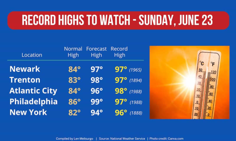
With the heat wave ramping up this weekend, New Jersey has a shot at seeing some records being broken, according to the latest temperature projections by the National Weather Service.
We likely tied the record in Newark on Friday, with recorded temperatures there of 100 degrees. Over the weekend, Sunday is shaping up to be the best opportunity for record highs to be matched or surpassed at each of the weather service’s three main weather reporting stations in the Garden State — Newark, Trenton and Atlantic City.
Still, that’s no easy feat. The current record highs for June 23 are 97 degrees in Newark and Trenton, and 98 degrees in Atlantic City.
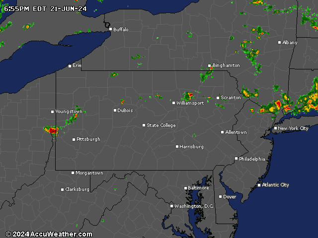
Current weather radar
The Associated Press contributed to this report.
Thank you for relying on us to provide the local weather news you can trust. Please consider supporting NJ.com with a voluntary subscription.
Len Melisurgo may be reached at LMelisurgo@njadvancemedia.com or on X at @LensReality.